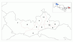
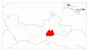
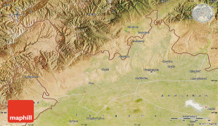
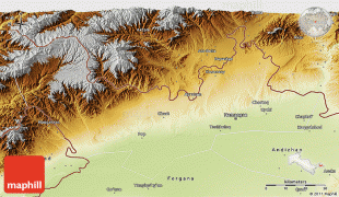
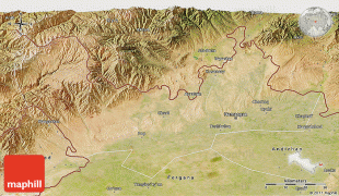
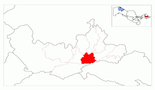
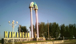
Namangan
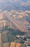
Namangan (Наманган) is a city in eastern Uzbekistan. It is the administrative, economic, and cultural center of Namangan Region. Administratively, it is a district-level city. Namangan is located in the northern edge of the Fergana Valley, less than 30 km from the Kyrgyzstan border. The city is served by Namangan Airport.
Namangan has been an important craft and trade center in the Fergana Valley since the 17th century. Many factories were built in the city during Soviet times. During World War II, industrial production in Namangan increased fivefold compared with that of 1926–1927. Currently, Namangan is mainly a center for light industry, especially in food. The officially registered population of the city was 475,700 in 2014. Uzbeks are the largest ethnic group.
The city takes its name from the local salt mines (in Persian نمککان (namak kan) — "a salt mine"). Babur mentioned the village of Namangan in his memoirs Baburnama. In his book A brief History of the Khanate of Kokand (Краткая история Кокандского ханства) (Kazan, 1886), the Russian ethnographer Vladimir Petrovich Nalivkin wrote that Namangan is mentioned in legal documents dating back to 1643.
The city of Namangan dates back to the 17th cent. A local salt miner's settlement (naman kann) appeared in the north of the Ferghana valley. The inhabitants of Aksikent (Ahsykenta) migrated here in the 17th Century after the destructive earthquakes. Aksikent is the old city that was once the center of the valley of Fergana. The city was the province's administrative centre in the middle of the 18th century (viloyat).
Namangan, like many other cities in the Fergana valley, was originally populated by Sogdian people, although it later became a Persian speaking city; the local variety of Persian became known as the Tajik language. An influx of Turkic-speaking people into the region, starting in late medieval times, led to turkification. While Namangan still had a Tajik majority until the middle of the 19th century, identification of its residents with Turkic rather than Iranian cultures has increased. By the late 20th century, most residents of Namangan speak Uzbek, albeit with a significant Tajik-speaking minority.
Politically, Namangan became a part of the Uyghur Empire of the Karakhanid State and was known to have been a settlement in the 15th century. The residents of the ancient city of Akhsikat, which was severely damaged by an earthquake, moved to the then-village of Namangan in 1610. Namangan became a city afterward. On the eve of the Russian invasion in 1867, the town had been a part of the Khanate of Kokand since the middle of the 18th century.
Namangan was hit by a destructive earthquake in 1926 which killed 34 people, injured 72, and destroyed 4,850 houses.
Since Uzbekistan's independence in 1991, Namangan has gained a reputation for Islamic revivalism, with many mosques and schools funded by organizations from Middle Eastern countries, including the extremist Wahhabi sect from Saudi Arabia that produced jihadist terrorists like Juma Namangani who fought and died in support of the Afghan Taliban and the Al Qaeda. This has also translated into political opposition against the secular government of Uzbekistan. Some women have discarded traditional colorful scarves for large white veils or even the black paranja.
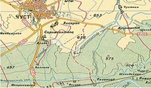
Map - Namangan
Map


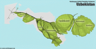
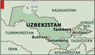
Country - Uzbekistan
 |
 |
| Flag of Uzbekistan | |
The first recorded settlers in what is now Uzbekistan were Eastern Iranian nomads, known as Scythians, who founded kingdoms in Khwarazm (8th–6th centuries BC), Bactria (8th–6th centuries BC), Sogdia (8th–6th centuries BC), Fergana (3rd century BC – sixth century AD), and Margiana (3rd century BC – sixth century AD). The area was incorporated into the Iranian Achaemenid Empire and, after a period of Macedonian rule, was ruled by the Iranian Parthian Empire and later by the Sasanian Empire, until the Muslim conquest of Persia in the seventh century.
Currency / Language
| ISO | Currency | Symbol | Significant figures |
|---|---|---|---|
| UZS | Uzbekistan som | so'm or Ñўм | 2 |
| ISO | Language |
|---|---|
| RU | Russian language |
| TG | Tajik language |
| UZ | Uzbek language |